Showing posts with label Ice Climbing. Show all posts

WAD Valley


December 14, 2016

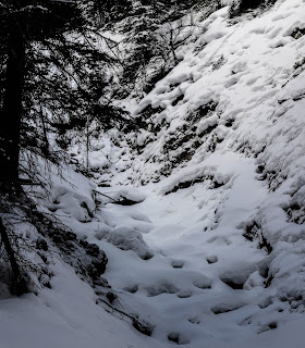
I returned to the Rockies on my vacation with my puppy and attempted to explore the WAD Valley. The exact whereabouts escaped me though it turned out to be relatively simple. On Maligne Lake Road you will continue south to the end of Medicine Lake.  Continue driving south past the Beaver Lake (Jacques Lake / South Boundary Trail) staging area.  Once the hill starts a gradual climb you've gone too far, and can circle back to the first (blatant) drainage on the side of the road.

Bear Spirit

February 13, 2016

This waterfall took me a while to get my bearings as to where it might be located.  I've read summer hikes of this trail, however I never heard anyone speak of a waterfall.  I proceeded skeptical, in search of what ice climbers call Bear Spirit.

Miette Falls

February 14, 2016

I first heard of this in search of ice climbs in Jasper.  I believe this one is called Rocky River Blues to the ice climbing community, however I went with a more proper title, denoting the Miette Range that it belongs.  The Rocky River is actually where this waterfall drains into, making it hard for me to commit to naming it after the river it later becomes.

I wasn't able to get a good enough angle of the waterfall from where I stood, however it is visible (mostly though a powerful zoom lens) from the Talbot Lake boat launch.  The picture above is from the pull over located in the middle of Talbot Lake, a couple kilometers further away from the waterfall.

I overshot the Talbot Lake boat launch thinking the bathroom stall located at the start of Jasper Lake would offer me a better view.  I was sorry to notice that the location was under repair with some heavy machines taking up the majority of the parking lot.  As I got a picture and was capable of noting this waterfall I decided that I would push onward on my journey looking for more ice climbs.

Drambouie Demon & Folding Curtain

February 14, 2016

Having located these two waterfalls has started a small change in my maps for the site.  As I had initially created a map for Rock Lake and a map for Whitehorse, I didn't have this area covered.  For now I've added these to the Rock Lake (which will now be known as Rock Lake & Hinton Foothills).  In the coming trips I believe I might be pushing more territory in the Hinton Foothill range, which may cause me to also meld Whitehorse into that as well.

Melt Out

February 14, 2016

This is a waterfall that took me by surprise.  I knew about Curtain Call further North and Tangle Falls to the South; however this easily miss-able waterfall is found in between on Tangle Peak.  I wasn't even sure this was a waterfall at first, but decided to pull over and take a picture anyways.

It was when I got home that I noticed this was a ice sheet, and after further research found out that it was an ice climb by the name of Melt Out.  In any case, this was a pretty waterfall, with a pop of light blue on an otherwise grey mountain rock.

Selenium Falls

February 13, 2016

The waterfalls of a few names, Selenium Falls also goes by Spray Falls or Spray River Falls.  I chose to stick with Selenium Falls as the Spray River is contained to the basin of the valley and doesn't start with this waterfall.  The trail is more commonly known as a "summer trail" to many people.  I'm not sure why, as this is an ice climb in the winter and though it isn't plowed, I've walked on much more difficult "winter trails".

Kerkeslin Falls

February 14, 2016

This marks a waterfall that I've known about for years, but for one reason or another had never pulled over to witness it.  Kerkeslin Falls even has a couple pull outs and even a campground to allow you to get in off the road and see the waterfall.  On my trip i pulled into one of the pull overs, which offered a broad view of the waterfall.
Mount Kerkeslin

Weeping Wall & Mixed Master

February 14, 2016

On my trip up from Banff to Jasper, I pulled over at the Weeping Wall to let Loki have some water and stretch his little puppy legs.  This isn't the first time I've stopped at this wall and it won't be the last.  Though this time I had a second look, noticing there was an additional ice sheet form.

The Urs Hole

February 13, 2016

For a short hike a lot happened to me on this one.  Down the road from Cascade Falls, you will continue until the road ends (where in the summer you would have access to Lake Minewanka).  I pulled in closer to the gate and settled off the road.  In reading the signs I came to notice that the road is closed as it's an animal corridor in the winter.  This means it allows access for animals to roam and claim as their home during the off season.

Rogan's Gully & Cascade Falls

February 13, 2016

Until I recently started investigating more ice climbs in the National Parks, did I realize that one winter many years ago I tagged a frozen waterfall.  I revisited this image before setting off this time around and confirmed that this was in fact Rogan's Gully.  I needed to ensure I was correct in my assumption so I set off for Cascade Mountain again, and sure enough found Rogan's Gully far off to the left hand side of Cascade Falls.

 Unlike on my trip 3 years ago, this time I was witnessing people pitch their climb up Rogan's Gully.  This further solved the mystery for me as I was aware this mountain is common to ice climbers.
Rogan's Gully


Peskett Canyon Falls

January 16, 2016

First off I could be here all day listing off some of the naming conventions of this canyon, creek and waterfall.  I will list the most common (and drop the other half dozen); Peskett Canyon, BAUTUS Canyon, End of the Line & O.D Canyon.

As the O.D. Creek flows in the opposing direction, on the other side of the mountain peak, I decided that this was not a proper naming convention of this canyon (despite the top of the waterfall starting from the O.D peak).  I also made a decision to drop BAUTUS Canyon, as this had been named by the ice climbing community.  Although this waterfall only really found recognition because of the ice climbers that climbed their ascent, one frozen winter; the name BAUTUS Canyon caused it to fall short for its presence in the summer months.

The region does however regularly speak of the creek as Peskett Creek, in both summer and winter, which causes me to continue with the name as Peskett Canyon Falls.

Mt. Elliot (Elliot's Left Hand, Kittyhawk)


January 16, 2016

In the winter this mountain becomes alive to the ice climbing community.  The most common of the ice climbs is known as "Elliot's left hand", though canyons and creeks around this mountain also have some lesser known ice climbs; the two that will be discussed on this day's adventure are Kittyhawk and the aforementioned Elliot's Left Hand.

The parking area for both of these waterfalls is on a side road off of the Highway (Hwy11) labeled Range Road 180A.  This road will veer down towards Abraham Lake, though in the winter is not completely kept plowed.  The good news is the plows apparently keep the inlet of the road clear, allowing for a slightly larger pull over off of the highway.

Note: I noticed a sign on my approach from Cline River, however did not see one on my return towards Nordegg.

Quick and Dirty

August 9, 2015

Easily noticed on the road to Cameron Lake, and yet hardly noticed as a waterfall.  Passed by bikers on their trail that runs along Cameron Lake Road.  Known by the ice climbing community as Quick and Dirty the water in summer months is down to a slow very fine trickle off the edge of Mount Crandell.  Though not impossible, for me to get down here in Winter is difficult.  As a result this will have to suffice until that day.  For now I realized there is a pull over spot off the highway next to this waterfall, though I'm unaware if this is maintained in the winter.

Vimy Falls (Irish Dream)

August 7, 2015

My return to Waterton Lakes National Parks for the first time since 2013!  As I pulled into the park early before my camp site was available for me, I planned to do some easy hikes to waterfalls in the park.  I would pull over on the road towards Balkiston Falls and the Red Rock Canyon.  On the spare chance my girlfriend pointed out a waterfall on a mountain I didn't expect to contain one.  The glimmer of the water on a bright sunny day gave-way to Vimy Falls.

Though it's thin this waterfall drops for almost the entire mountain, even though I arrived late in the higher water flow season.  Also the distance from my pull over sight was immense and in need of a much better zoom lens.  I would recommend crossing the highway and heading into to the field where you might be able to take in the waterfall better than I have to offer here.


Update: just discovered that this is an ice climb in winter months; known to the ice climbing community as Irish Dream.

Ogre Canyon

June 27, 2015

This remote location in the foothills of the Rocky Mountains have some of the most stunning, awe inspiring views.  Standing high enough in the mountain, at times, to see eye-level with the peaks in the distance offers a view not found often enough on the Alberta side of the Rockies.

Like the last time I went out this way, I would travel through the small village of Brulé.  Once you reach the gate at the other end of the village you will start a rough 8 Kilometers of rugged off road.  Unlike many of the fire roads I've come across in the mountains, this path is by far the most rugged I've seen to date.  The last four kilometers alone took me 45 minutes in my Subaru Imprezza.  Note: please close the gates behind you!

Morro-Hawk Canyon

May 30, 2015

This trip was to redeem my May plans of biking in the Ghost Region.  Though I didn't bring my bike, I did bring man's best friend along with me.  As my girlfriend and her uncle were tourists in Jasper for the day, I had only a couple hours with my puppy on this mountain.  I would caution when bringing a dog along with you that on this mountain I have always seen goats, in a large 20 plus size family as well as the biggest cougar tracks imaginable. 


Grotto Canyon

April 17, 2015

This trip would be my Walk For Wildlife (+Canadian Wildlife Federation) hike of the year!  I was excited for many reasons, one in particular for the CWF's Species At Risk, and as this would be the first family trip for my girlfriend and I to bring along our new puppy Loki.  The real good news is he was great on camera, as a camera and even better at keeping to the trails with me.

There will hopefully be more trips with him in the future.

Bourgeau Falls

February 14, 2015

Once you've loudly swallowed all your fear after seeing the sign above, you can move on to Bourgeau Falls.  This frozen waterfall is found on Mount Bourgeau with access from the Sunshine Village, ski resort.  The best place to park is in the far back near the maintenance lot of the Sunshine Village.  However I know this can be hard as you are sometimes forced to park on the road a long way out from the resort.
Sunshine Village

Maligne Canyon

January 31, 2015

Though my initial attempt would be Morrow-Hawk Canyon, I was chased off the mountain top by sheep.  So not a bad second option.  I've come to this canyon a few times now, but today was the first time I made it during a decent freeze.  Though this winter has mostly been a prolonged spring, it was cold enough in the early going of the day to keep most of the water locked away in ice.

Ogre Canyon

January 31, 2015

As the sun came up on the Rockies I was hoping I would be exploring new territory in the foothills of Jasper National Park.  Ogre Canyon is found at the bottom tip of Rock Lake Provincial Park; bordering the East of Jasper National Park.

To venture in this area I learnt a few things this day that I wasn't able to uncover online.  Just West of Hinton you will take the highway north bound to Grand Cache; and continue on this road for a ways until there is a marked turn off for Brulé.  Once you have taken this left you will follow the Brulé sign until the end of the road; which comes to the fence (pictured above).